

The journey to Uhuru Peak begins with a Mount Kilimanjaro map. Maps aren’t just images. They are the ultimate guides to the adventures you long for. Climbing Kilimanjaro is a journey through a rich cultural landscape; the dense rainforest bubbles with wildlife of every size. The high mountain deserts and frozen glaciers make a fantastic view. But before you get ready for your hike, you need to understand the lay of the land.
Where is Mount Kilimanjaro? Kilimanjaro is in the northern part of Tanzania, near the border with Kenya. The summit of the mountain is located at the Kibo crater, at 5,895 m (19,341 ft). It is Africa’s highest point and holds the world record of being the highest freestanding mountain above sea level. There are several routes to the peak and back to the mountain’s base. This guide will show you all you need to know about Mount Kilimanjaro.
What Makes Kilimanjaro So Special?
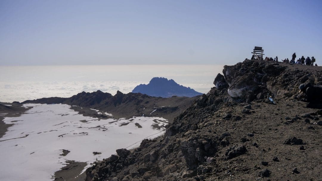
Kilimanjaro is a dormant volcano with three extinct eruption sites: Kibo (the earliest and highest), Mawensi (at 16,893 ft), and Shira (at about 13,000 ft). Kibo summit is well known for its massive ice cap, while Mawensi is known to have jagged edges and cliffs. Hans Meyer and Ludwig Purtscheller first reached Kibo, the Summit, in 1889. Meyer was a German geographer, and Purtscheller was an Austrian mountaineer.
The Mount Kilimanjaro map shows you trail details and regional settings. You also get to see the layout of each route. Kilimanjaro is a major hiking and climbing site. You can get to Uhuru Peak by seven main routes. It might take a longer time, depending on your preferred route, to reach the top. No matter how long or short the trail you follow, it is still an unforgettable experience.

Map of Mount Kilimanjaro in Africa
Mount Kilimanjaro was formed through volcanic eruptions over the course of two millennia. Over time, several factors have contributed to its current state. In the 20th century, it was designated a nature reserve. The Kilimanjaro National Park was founded in 1973. This was a move aimed at protecting the mountain and its surrounding forest. It was named a World Heritage by UNESCO in 1987.
The map of Kibo crater on Mount Kilimanjaro was first published by a British government agency, the Directorate of Overseas Survey (DOS), in 1964. This became the template for succeeding maps of Mt. Kilimanjaro in Africa.

What Are The Routes to Mount Kilimanjaro's Summit?
The journey to Africa’s top begins with the route you take. There are many paths to the top, each one unique. Whether you want to go fast or enjoy the view at a slower pace, a Mount Kilimanjaro map will get you started.
Marangu Route:
This is the most popular route in terms of the mountain. It is also known as the “Coca-Cola route.” This route is more crowded than the others because it is the easiest route. You don’t need technical camping gear, and it’s newbie-friendly. This route doesn’t offer much in terms of scenery, but rainforests surround it. It’s the only route that has huts for hikers to rest.
The major huts include:
- Mandara Hut.
- Horombo Hut
- Kibo Hut
The huts are not fancy. They are just enough to meet basic needs. The entire journey through here takes about 6 days, including a pit stop at Horombo Hut to help climbers acclimatise. It is estimated to have a success rate of 50-60%.
Machame Route:

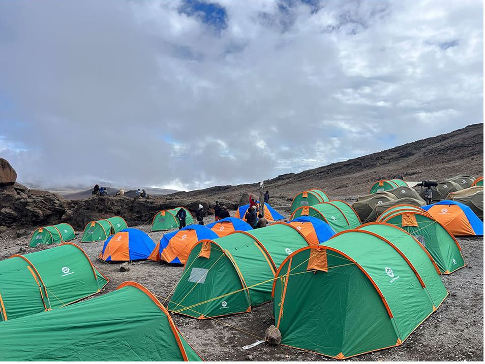
It’s the second most popular route, also known as “Whiskey Route.” The trail gets its nickname because it’s more challenging than the Marangu (Coca-Cola) trail. It is well-known for its heathland, thick rainforest, alpine desserts, and the challenging Barranco Wall. There are no huts, but hikers can camp with tents.
The main camps include:
- Machame Camp
- Shira Cave Camp
- Barranco Camp
- Barafu Camp
It is also crowded like Marangu. Unlike Marangu, it has a 70-85% success rate. The trek typically takes 6 to 7 days to complete. The experience on this trail is worth every strain.
Lemosho Route:
This trail is perfect for climbers who prefer fewer crowds. It is remote with stunning views of the alpine desert and rainforests. If you love quiet, this trail suits you. The climb to Uhuru Peak starts west of the mountain. Going via Lemosho helps climbers acclimatise well. Beginners can take this route, as it is not too difficult. It takes climbers 8 days to complete the hike.
The main camps include:
- Mti Mkubwa
- Shira 1 & 2 Camps
- Barranco Camps
- Karanga Camps
- Barafu Camps
The Lemosho route boasts a high success rate, with an 80-90% success rate. It balances success with nature’s beauty. Could this be your chosen start point?
Rongai Route:
This route holds the promise of lovely scenes and quiet trails. It is less crowded and perfect for those who prefer calm places. The climb begins at the Nalemoru Gate at the northern side of the mountain. This side of the mountain experiences lower rainfall. It is ideal for a hike during the rainy season because it is primarily dry. Many hikers love this route because of its gentle climb and views of the Kenyan plains and mountain deserts.
Its main camps include:
- Simba Camp
- Second cave
- Kikilewa Camps
- Mawenzi Tarn Camps
- Kibo Camp
The climb takes about 6-7 days. It has a high success rate of 65-80%. The gentle climb allows for proper acclimatisation.
Northern Circuit Route:
This is the longest route to the top of the mountain. Hikers on this route enjoy maximum acclimatisation. The climb starts from the west at Londorossi Gate (same as the Lemosho route). It continues through Shira Ridge and Shira Plateau before heading north. Considered a challenging trail, it takes an average of 9 days. This route gives hikers a wide view of the mountain and its surrounding peaks.
The main camps include:
- Shira 1 & 2
- Moir Hut
- Buffalo Camp
- Third Caves Camps
It has the highest success rate, exceeding 90%. For a more secluded feel, this route is your best bet.
Umbwe Route:
If you love a challenge, then you’ll enjoy this route. It is known by hikers to be the most difficult climb. It is also the shortest route. This trail is ideal for experienced climbers seeking a quick challenge with fewer crowds. The climb starts south of the mountain. It’s a direct climb with little time to adapt to the elements. This could lead to altitude sickness. It’s a 6-7 day trek. There are no huts, and you can only set up tents.
The main camps are:
- Umbwe Cave Camp
- Barranco Camp
- Karanga Camp
- Barafu Camp
With the lowest success rate, successful climbs are calculated at 50-60%. If you’re confident and experienced with tedious climbs, go for Umbwe. Prepare adequately before the climb.
Shira Route:
This is another challenging route. Hikers do not frequently use it because its starting point is at a high altitude. There’s little time for climbers to adjust to the altitude. The first camp is located at an elevation of 11,800 ft. Hikers start the trek at Shira Ridge through the Shira Plateau. Then the journey continues along the Southern Circuit path and on to Barafu. After reaching the summit of Mount Kilimanjaro, hikers will descend via the Mweka Route. It takes 6-8 days to complete the hike.
The main camps are:
- Shira 1 & 2 Camps
- Moir Hut
- Lava Tower
- Barafu Camps
The Shira trail is similar to the Lemosho route. The altitude, however, is the only difference. Its success rate is estimated at 60-75%. Hikers need to be fit and able to adapt quickly to high altitudes.
BONUS TIP:
It is essential to note that all the aforementioned routes utilise the Mweka route for descent, except for the Rongai and Marangu routes.
What is The Western Breach?
The Western Breach is a straightforward trail that goes directly to the Kibo Crater. Hikers on the Lemosho, Shira, Machame, and Umbwe routes can access it. It’s located on the western side of the mountain and serves as an alternative to the Barafu Camp. It is remote with very few crowds, and also offers a challenging climb for those who can handle it.
This trail is short and gives hikers more time to explore the insides of the Kibo Crater. As lovely as this is, it remains the most treacherous route. This route is closed as of today due to the risk of rockfalls following the heavy rains that have altered rock stability. Contact the Kilimanjaro National Park or your tour operator to know the possibility of its reopening.
Your Kilimanjaro Adventure
Climbing Mount Kilimanjaro is not just about getting to the top. It’s all about planning and choosing the path that suits you. A Mount Kilimanjaro map gives you a full view of the trail on each route. It shows you the camps and allows you to prepare for what you will experience. We provided you with detailed maps and expert tour guides for a safe and smooth experience. If you are unsure where to begin your African adventure, start here.
Frequently Asked Questions
1. Where is Kilimanjaro located?
Kilimanjaro is located in northern Tanzania. It is very close to the Kenyan border.
2. How many days does it take to climb Mount Kilimanjaro?
It takes between 5 and 9 days to climb Kilimanjaro, depending on the route you take.
3. Do I need a map for my climb?
Yes, you need a map of Mt. Kilimanjaro in Africa. It will help you better understand the terrain.
4. How many routes are there on the Mount Kilimanjaro map?
Seven primary routes lead to the summit of the mountain. They include the Marangu, Machame, Lemosho, Rongai, Northern Circuit Route, Umbwe, and Shira routes.