

Mount Everest is the tallest mountain in the world. It’s about 8,848.86 meters high, and people all over the world want to see it or climb it. If you’re curious about how tall Everest is compared to other famous mountains, its height exceeds Africa’s highest mountain by over 3,000 meters. Yet many people still wonder: where is Mount Everest on our planet?
This editor of Zara Tanzania Adventures will guide you to its exact location and why its spot on Earth is Iconic.
Which country is Mount Everest in?
Mount Everest is right on the border of Nepal and the Tibet Autonomous Region of China. The exact coordinates are 27.9881° N, 86.9250° E.
This fascinating position makes it unique among the world’s other high peaks because it straddles the border of two countries simultaneously. What’s more amazing is that the very top of the mountain is the border itself! The south side is all in Nepal, and the north side is in Tibet. Because of this, people can climb it from either country, and each side has developed its own distinct climbing routes to enhance the experience for trekkers and mountaineers.
Apart from knowing that it’s a border mountain, understanding where Mount Everest is located explains why climbers can have two totally different experiences, depending on which side they choose to climb from.
Where is Mount Everest in Asia?
To get a real sense of where Mount Everest is in Asia, you’d have to consider its position within the vast Himalayan mountains. Everest is in the Mahalangur part of the Himalayas, a massive range that goes through Bhutan, India, Nepal, China, and Pakistan.
The Himalayas are among the world’s youngest and most active mountain ranges. They were made when the Indian and Eurasian plates crashed into each other around 50 million years ago, and they’re still getting bigger! Mount Everest’s location within these mountains places it at the heart of some of the world’s most “dramatic” geological activity.
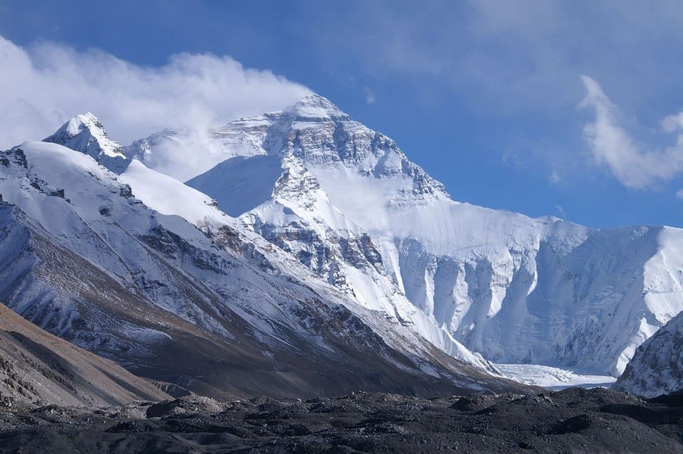
View of Mount Everest rising above the Tibetan plateau
Mount Everest’s location creates key geographical relationships with its surrounding areas. Some of them are
- Sagarmatha National Park: On the Nepalese side, Everest is situated within the protected area, making it a designated UNESCO World Heritage Site.
- Qomolangma National Nature Preserve: This is also a protected area on the other side of the mountain in Tibet.
- Khumbu Valley: The usual southern route used to climb Everest goes through this valley in Nepal, which was formed by a glacier.
- Rongbuk Valley: The northern route in Tibet also goes through this old glacial valley.
Why was Peak XV named Mount Everest
A good question would be “how did Mount Everest get on the map?”. It all started with the British colonial surveying efforts in India. In the 1850s, this project – the Great Trigonometrical Survey of India found a mountain they labelled “Peak XV”
Andrew Waugh, who led the British surveyor general’s team, discovered that Peak XV was taller than any other mountain they were aware of. He figured it was about 29,000 feet above sea level.
If you’re curious about how tall Everest is compared to other famous mountains, its height exceeds Africa’s highest mountain by over 3,000 meters.
Later, they named the peak after Sir George Everest in 1865. He was the surveyor general in India at the time and initially opposed having the mountain named after him.
Lorem ipsum dolor sit amet, consectetur adipiscing elit. Ut elit tellus, luctus nec ullamcorper mattis, pulvinar dapibus leo.
What is Mount Everest Known As Locally?
Different cultures have different names for Mount Everest:
- Sagarmatha: Nepali name, meaning “Goddess of the Sky”
- Qomolangma: The Tibetan name, which translates to “Goddess Mother of the Earth”.
- Chomolungma: Another Tibetan name that points to the mountain’s holy, feminine side.
These names show the deep spiritual connection that local people maintain with the mountain. They see it as sacred, not just something to climb.
Climbing Routes and Access Points
There are two main climbing routes. Each has its own advantages and disadvantages based on the mountain’s spot on the border.
Nepal Side: The Southeast Ridge Route
The standard route to climb Everest from Nepal follows the southeast ridge. This route was first used by Sir Edmund Hillary and Tenzing Norgay in 1953 when they first made it to the top. They got to the summit on May 29, 1953, proving it could be done. The route usually includes:
- A Flight to Lukla Airport.
- Hiking through the Khumbu Valley.
- Getting used to the altitude at different camps.
- Experiencing Everest Base Camp at 5,364 meters.
- Climbing carefully through the Khumbu Icefall.
Reaching the top of Everest by the southeast ridge.
2. Tibet Side: The North Ridge Route
The north side of Everest, up from Tibet, is a whole different route. Most climbers choose this route because it provides vehicle access closer to base camp. But it’s not without its problems.
The route usually includes:
- A drive from Lhasa.
- Experiencing the North Base Camp, which sits at 16,900 feet.
- The climb itself isn’t as technical, but it takes more time.
- Since you’ll be driving so high, you’re more likely to get altitude sickness.
Is it Easier to climb Everest from Nepal or China?
Choosing which route to climb Everest depends entirely on preference and affordability. To help you make an informed decision, the table below compares the benefits of each route.
Comparison Factor | Nepal Route | China Route |
Infrastructure | More established with tea houses and lodges | Basic facilities, mostly camping |
Emergency Services | Better evacuation options via helicopter | Limited rescue services, longer evacuation times |
Weather Windows | More predictable climbing seasons | Less predictable, shorter windows |
Crowds | More crowded, especially during peak season | Less crowded, more solitude |
Permit Costs | Higher permit fees (around $11,000) | Lower permit costs (around $7,000) |
Understanding the cost of climbing Mount Everest involves more than just the permits. Total expenses range somewhere between $35,000 and $100,000, depending on the route you pick and what services you use. Choosing a route often comes down to personal choice, budget, and your climbing experience. It’s not really about one route being easier than another.
What Are The Environmental Challenges and Altitude Considerations?

Mount Everest’s location poses extreme environmental issues. When climbers get above 8,000 meters on Everest, they hit what’s called the Death Zone. Up there, the oxygen is only about a third of what you’d get at sea level.
Altitude-Related Factors
- Low Oxygen: At the summit of Everest, there’s only one-third of the oxygen that exists at sea level. The air is thin, making it hard to breathe. Most climbers require supplemental oxygen above 7,000 meters because each breath is crucial for safety.
- Extreme Cold: During winter, the temperature level can get to -60°C (-76°F). Even during climbing season (April-May and September-October), it’s not often warmer than -15°C (5°F). During this time, you can easily get frostbite, so it’s advisable to get specialised cold-weather equipment.
- Good Weather Times: You can only climb Everest at certain times due to monsoon and jet stream patterns. The jet stream usually goes north of Everest in late May, which gives you a short window of calmer weather for 4-7 days to try and get to the top. Missing it means you’d have to wait a whole year..
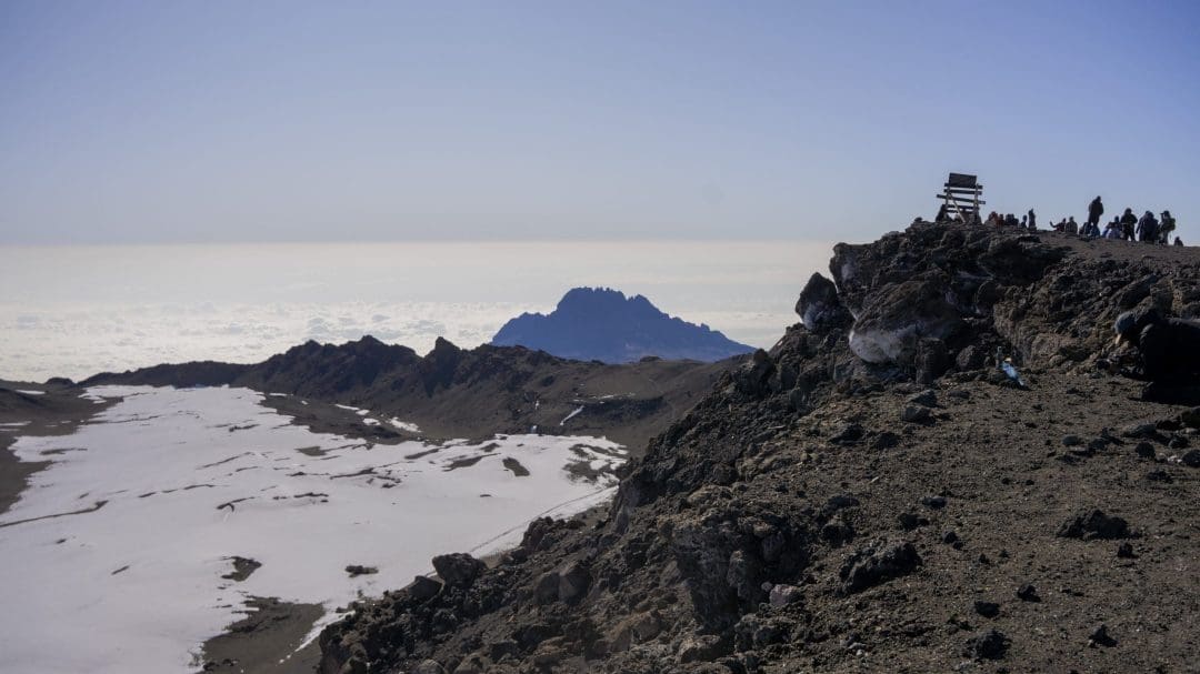
Understanding the challenges associated with specific locations explains why climbing Everest requires months of preparation and incurs significant costs. Many mountain climbers find climbing Kilimanjaro a valuable learning experience for those new to climbing before attempting to climb Everest.
Interesting Facts About Mount Everest
- Mount Everest gets about 4 mm taller each year because of how the Earth moves.
- The air at the top is really thin. There’s only a third of the oxygen there compared to what you’d find at sea level.
- In the spring of 2023, about 466 mountaineers from 43 groups obtained permits to climb Everest, according to Business Standard.
Travel Tips for Visitors
You don’t have to climb Mount Everest to enjoy it. Many people opt for the Everest Base Camp Trek in Nepal. It’s great because:
- You get to walk through Sherpa villages and see Buddhist places.
- The views of the mountains nearby are fantastic.
- You’ll see Sagarmatha National Park, a special place recognised by UNESCO.
The best times to go are before the rain (March to May) and after the rain (September to November) since the skies are clear then.
From Everest to Kilimanjaro: Finding Kilimanjaro

We’ve spent the entirety of this blog discussing the location of Mount Everest, and this is only the beginning of the adventure that awaits you. On this adventure, you will experience the appeal of the Himalayan sunrise and the resilience of the Sherpa culture.
For new climbers, Mount Kilimanjaro is a great starting point. If you’re curious about the exact location of Kilimanjaro or how to get to Kilimanjaro, we present all you need to know. You would be travelling with people who see adventure as something special. We will be with you from the start of the adventure until you’re standing on the roof of Africa.
Frequently Asked Questions
1.Which country does Mount Everest belong to?
Mount Everest is located on the border between Nepal and China. The summit sits precisely on the international boundary between Nepal and Tibet.
2. Is Nepal part of China, and what country is at the base of Mount Everest?
No, Nepal is not part of China – it’s an independent country. At Everest’s base, you’ll find Nepal on the southern side and Tibet (part of China) on the northern side.
3. Can anyone climb Mount Everest, and which side is better to approach from?
While anyone can attempt to climb Everest with the proper permits, it requires extensive training and significant financial resources. The choice between the Nepal and China routes depends on your experience level, budget, and preferred climbing style.
4.Is Mount Everest located in Japan?
No, Mount Everest is located on the Nepal-Tibet border in the Himalayas, not Japan. Japan’s highest mountain is Mount Fuji at 3,776 meters – much shorter than Everest’s 8,848.86 meters.